Monday, 22 August 2011

Chilled out - eventually!


This should really be a picture of a ready to go kayak with no kayaker. We all have those days when we forget something, like the VHF for example. I searched all the hatches, dry bags and the cockpit several times. I turned the car inside out, twice. My wife went back to our hotel room, as did I subsequently. Could we find the blasted thing? No. I'd just about given up when I suddenly remembered ..... back at the hotel I'd put it in the hydration pack pocket in the rear of my BA. Argh! An hour or so wasted.
So eventually, off I paddled up the north-east cost of Colonsay. Can you detect my mood from my posture?
 Having paddled about a kilometre north from Scalasaig I had eventually paddled out my mood and was fairly chilled out like these four feral goats, presumed ancestors from goats that wound up on several Scottish islands after the Armada.
 Further up the coast again are the ruins of Riasg Buidhe. An eighth century cross where the stone is described by William Stevenson in 1880 as  "dressed only in front, undressed on the back" was removed from  here in 1870 to Tobar Odhran by Colonsay House. Suffice to say there's Christian symbology on the front and and something rather ruder on the back! The 1841 census has 64 people living here and the village remained occupied to a lesser extent until 1923, when the last inhabitants were re-housed in new houses at Glassard, just north-east of Scalasaig. With that move Colonsay became the first community in Britain where every household had running water and lavatories. The roofs of the houses at Riasg Buidhe were burnt to prevent their reoccupation. A certain Collach, Dr. Roger McNeill, an internationally recognised authority on infectious diseases, particularly tubercolosis, was the prime mover in this achievement. This and more information can be gleaned from Kevin Byrne's excellent book, "Lonely Colonsay, Island at the Edge". 
 Heading north the coastline scenery takes on a certain uniformity with the exception of Eilean Olmsa and the woodlands of  A' Choille Mhor and A'Choille Bheag. Seals, otters and goats abound and there is the chance to spot a goldean eagle. Landing opportunities are limited until you reach the beach at Balnahard or Traigh Ban.
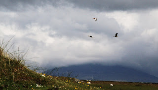
 From Balnahard it is only a short paddle to the cliffs at the north of Colonsay. The fulmars hereabouts were very inquisitive, flying within catching distance of my head.
 On reaching the northern tip, where the tide can really pull you along or push you back, the skerry of Eilean Dubh comes in to view as does the view towards Mull and northern Jura. Views to follow!

Friday, 19 August 2011

South East Colonsay

 Leaving "her outdoors" on Oransay, I paddled on out of the Strand and up the south east coast of Colonsay.
 Through Port a' Chapuill to... 
 ... Cable Bay. The beach here is "compact" but with a view down to the Sound of Islay and the Paps of Jura. Port a' Chapuill and Cable Bay are counted as seperate beaches in the SNH top 20. Given their close proximity I struggle with this when the whole of Oransay is counted as a single unit! Cable Bay as a top 20? Possibly. Port a'Chapuill on its own? Not in my book! But then it is all rather subjective anyway.

 Interestingly, a proposal has recently (spring 2011) been put forward to place a salmon farm off Cable Bay / Port a' Chapuill. Personally I hope it doesn't proceed. It's very pleasant to kayak somewhere off the west coast without the infernal things. 
 Just around the corner from Cable Bay is Meall an Arbhair, a pleasant sheltered spot with two entances to the shallow bay and otters chilling out.
 
 Rubha Dubh is a very low lying headland. Beyond is Loch Staosnaig otherwise known as Queen's Bay, on account of HMY Brittania regularly mooring up here for the night when HM was doing her holiday tour around Scotland.
 Views to the northeast include the northern end of Jura, the mouth of Corryvreckan and the rounded lump aka Scarp.
 
Meanwhile the tide was going out and I needed to get back to Oransay sharpish to collect "her outdoors" and then paddle back to the road's end at Garvard otherwise there would be a long trolley haul.

Monday, 15 August 2011

Oransay Priory

 Oransay Priory was founded around 1350 as an Augustine monastary but was reported as being in ruins by 1623. The current owners of Oransay have done much to improve the island and this includes moving the superb collection of carved mediavel grave stones in to a recently roofed area of the priory to protect them from the elements. 


OK, not part of the priory proper, but I like this shot of the nearby walls with the three baby wrens!
Again, not  a carving but a fascinating natural detail of one of the stones in the priory wall.

All photos on this page by Angela Smith

Sunday, 14 August 2011

Oransay

 Our first trip to Oransay was on foot. Having waited for the tide to recede we crossed the Strand, walked the road to the priory then on to the machair. Waders, corncrake and geese abound. Several areas of the island, including some of the beaches, obviously held large numbers of ground nesting birds and we did the sensible thing and avoided them.

 This isolated shelter on the south west coast had a superb view towards some offshore skerries and islands and out in to the Atlantic.
 Colonsay and Oransay were occupied in the Mesolithic period. On Oransay this is evidenced by several shell middens such as the one above, near Seal Cottage.
On the east coast the view opens up towards Jura and Islay. Jura has three of the SNH "top twenty" beaches.
 One of the Jura paps.
When we crossed the Strand to Oransay it was pretty grey and wet but upon our return the weather had brightened up and better displayed the brilliance of the place.

All photos by Angela Smith

Saturday, 13 August 2011

"Do the Strand"

With apologies to all those who are old enough to know of the avant garde hip chic of 1973....

There are two ways to "Do the Strand".
You can walk across when the tide is out
Or you can paddle across when the tide is in
Of course if you paddle across, you could do it on a table..... sorry! 1973 and all that.

This day we paddled, in kayaks, and the photograph is historic as this is the first time that Angela has been in a kayak on the sea since we were last on Colonsay thity years ago.

 The Strand we are really talking about here is the one between Colonsay and Oransay. The latter island is regarded by the authors of the SNH report referred to in my earlier Colonsay blog as one of the four top twenty beaches, although calling a whole, fairly large island "a beach" is using a bit of licence. There are many fine beaches on the island, which is leased to the RSPB by its American owner. There are also the remains of a rather old priory. 


And the rather nice beach we landed on.

Wednesday, 3 August 2011

Look out below!

At the weekend Fiona and I went for a 25k bimble around the Ormes from Rhos. I'm not sure if it's a bright idea to leave Rhos at high tide as inevitably you will have the tide against you during the paddle back and then a long carry up the beach at the end of the day. Gluttons for punishment, eh?

Whilst doing some rock-hopping under the cliffs of the Great Orme we were suddenly assailed by a fall of stones from above. We paddled away from the cliffs to see what had caused the fall only to see these three Angora billy goats chewing the barest of vegetation. All the other lusher, verdant green stuff and they had to choose this bit just as we were paddling underneath! 
On the way back the tide was falling and thousands of starfish were exposed on the rocks around the Little Orme. They were slowly peeling themselves off the exposed cliff and falling back in to the relative safety of the sea. I managed to catch one on my paddle as it dropped! 

Monday, 1 August 2011

Kiloran Bay, Isle of Colonsay

 Kiloran Bay can catch magnificent surf and, as is often the case in this part of the world, there won't be many of you on or in the water!
If the surf is high then I found the best place to land the kayak was at the southern end of the beach where the stream enters the sea, although with rocks close by and challenging surf, good judgement is needed. If it is too difficult to land then there is a more sheltered north facing beach about 300m west: not too sure how you climb the cliff though! Failing that there is a small south-westerley facing bay round the headland north of Kiloran Bay.

 The bay is backed by an impressive dune face with machair behind, which is managed to provide a foraging area for the rare chough, at their most northerly breeding area in Europe. Corncrakes rattle away nearby while dune gentian and Irish ladies tresses are amongst the rarer flowers in the vicinity. In 1881 a viking ship burial site was found in the dunes. The artefacts can be seen at the National Museum in Edinburgh.  
When on the west coast it is always tempting to "do the sunsets".
I rather like Kiloran Bay.